Problem
Ground-based optical tracking is the cheapest way to keep custody of objects in high orbits, and the hardest data to work with. Passes are short, gaps run to days, and the objects that matter most are often close to the detection limit. An orbit fitted to that data can look precise and still be wrong, because the reported covariance reflects the fit rather than the observation geometry that produced it.
Capability
My team develop the full path from photons to orbit solutions: image processing that pulls astrometry from faint and streaked detections, association and initial orbit determination for short arcs, and estimation that propagates realistic uncertainty rather than an optimistic fit residual.
Alongside this, the UNSW Observatory has been automated for remote and programmatic operation, so tracking can be tasked against a target list instead of scheduled by hand.
Satellite polarimetry extends the same sensor from tracking towards object characterisation — inferring attitude and surface properties, not just position. This is the ongoing PhD project of Asad Rizvi, and it is at an earlier stage than the tracking and automation work above: the observing approach is being developed on the UNSW telescope, with research outputs still to come.
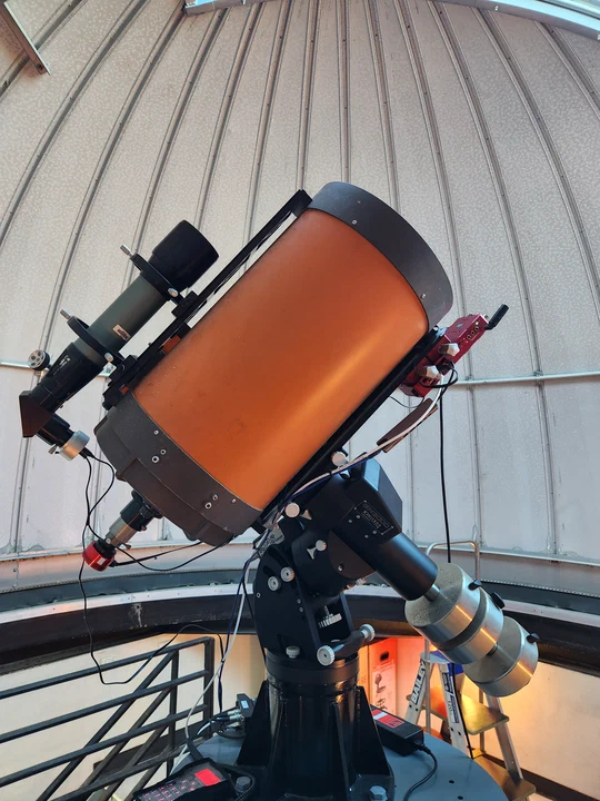
The UNSW Observatory telescope on its equatorial mount, with control computer, guide scope and imaging camera fitted.
Demonstrated result
- The UNSW Observatory now runs automated, remotely controlled satellite tracking. The automation and control work was delivered as an undergraduate thesis project by Tejas Margapuram (slides).
- A modular three-tier control system now drives the observatory, designed, implemented and deployed by undergraduate thesis student Darcy Faulkes: an ASCOM Alpaca server abstracting heterogeneous hardware, a backend for visibility prediction, scheduling and orchestration, and a web frontend. Remote control was verified against third-party clients, and a complete satellite observation was carried out autonomously, with no human intervention.
- An end-to-end optical space surveillance and tracking pipeline runs from raw frames to orbit solutions (overview slides).
- An automated satellite tracking control project was funded by the NSW Space Research Network for 2025–2026.
- Astrometric analysis of satellite streak images was developed end to end as a supervised thesis project, extending the pipeline’s usable detection range.
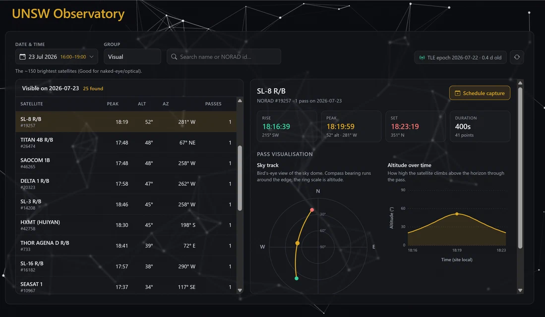
The observatory tasking interface: satellites predicted to be visible on a given night, with sky track and altitude profile for the selected object and one-click schedule capture. This is the top tier of a three-tier architecture built by undergraduate thesis student Darcy Faulkes — an ASCOM Alpaca server abstracting the observatory’s heterogeneous hardware, a backend handling visibility prediction, scheduling and orchestration, and this web frontend.
External use
The observatory is used for research and for space engineering education at UNSW, and it is the sensor behind the tracking pilot offered to partners.
Next partnership opportunity
A tracking campaign against objects you nominate, returning astrometry, orbit solutions and a residual and accuracy report — enough to judge whether a taskable optical sensor belongs in your architecture. See Partner with us.